I’ve been asked this question more times than I can count (I’ve asked it myself plenty of times too…). Usually by non-photographers, usually with a slightly accusatory eyebrow raise, as if the drone has somehow made the whole thing too easy. But occasionally by other photographers too – and that’s where it gets more interesting.
I use a drone. I have done for a few years now, first with a DJI Mavic Air 2, and then an Air 2S and more recently a Mavic 4 Pro. Some of my most popular images (on social media) were taken from the air. And yet – if you asked me which of my photos feel most like mine, most of them would be taken with my feet on the ground.
So do I think drone photography is cheating? The honest answer is: it depends what you mean by cheating, and who you think you’re cheating.
The case against
The sceptics have a point, actually.
I’ve done a number of photography talks over the years, and during one of them I put up a selection of my drone images. Before I’d even said a word, someone in the audience piped up – ‘oh I don’t like drones, they’re annoying.’ And that pretty much sums it up. Drones are Marmite in the photography world, and probably always will be.
And to be fair to that audience member, there are legitimate reasons why people find them irritating. The noise is the obvious one – even the quieter consumer drones have a distinctive whine that carries across an otherwise peaceful landscape. They can sound like a swarm of angry mosquitos (and for the larger ones, a swarm of giant hornets). There’s also a suspicion factor; people see a drone overhead and immediately wonder if they’re being filmed, which is understandable even if the photographer is pointed in completely the opposite direction. Privacy concerns around drones are real, and as photographers we’d do well to acknowledge that rather than dismiss it. None of that makes drone photography wrong – but it does mean we have a responsibility to be thoughtful about where and when we fly. I’m careful about where and when I fly – only sunrise, away from people.
There’s a long-standing idea in landscape photography that the image should cost you something. The early alarm. The cold. The walk in the dark with a heavy bag. The waiting. That relationship between effort and reward is part of what gives the genre its particular character – and it’s why a photograph of somewhere genuinely remote or difficult to reach carries a different weight to one taken from a car park.
A drone changes that equation. You can be standing in a perfectly comfortable spot and still get an aerial perspective that would have previously required a helicopter, a plane or a very tall ladder. The physical challenge – the being there – is partially removed from the equation.
There’s also the perspective argument. Landscape photography has traditionally been about a human relationship with the land. You’re standing in it, experiencing it, reacting to it. A drone separates you from this. The camera is up there; you’re down here. Is that the same thing?
And then there are the purists who will point out that many prestigious competitions either exclude drone images from certain categories or separate them out entirely. That’s not nothing.

The case for
Here’s the thing though. Drone photography is hard.
Not in the same way that lugging a tripod up a hill in the dark is hard – but genuinely, technically challenging in its own right. Learning to fly well, understanding the light from above, composing an image when you can’t look through a viewfinder, managing battery life and wind and airspace restrictions – none of that is trivial.
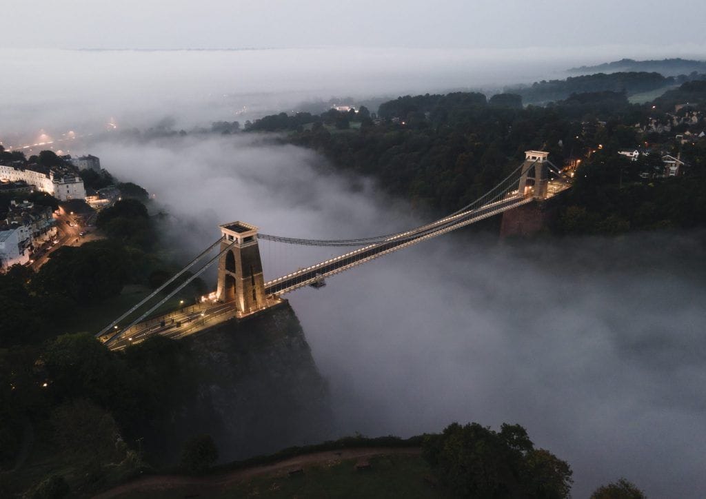
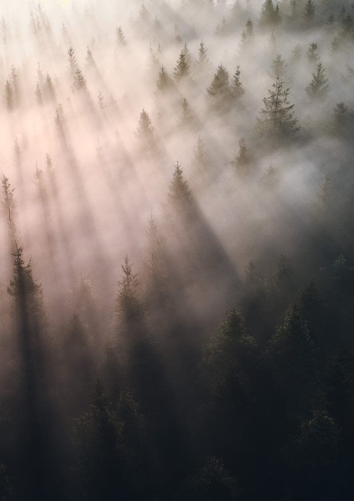
And the perspective argument cuts both ways. Yes, a drone removes you physically from the scene. But it also shows us things that are genuinely invisible from the ground. Clifton Suspension Bridge emerging from a sea of mist at dawn. A river of mist winding through the Wye Valley. The abstract shapes in a forest canopy. These aren’t shortcuts to a view you could otherwise get – they’re entirely new views that didn’t exist in landscape photography before.
Some of my favourite drone images have been from just a few extra metres altitude – but the difference this can make to a view and a photograph can be staggering.
Is showing someone something they’ve never seen before cheating? That seems like a stretch.
The bit nobody talks about – the rules
Here’s something that gets glossed over in the “drones are cheating” conversation: flying legally in the UK is genuinely not straightforward.
The Civil Aviation Authority has strict rules about where you can fly, how high, and how close to people and structures. Large chunks of the country – including most of Bristol city centre – are restricted airspace. Many of the most photogenic spots sit within controlled zones that require permissions that aren’t easy to get. National Parks have their own guidelines on top of that.
Doing this properly means getting your CAA flyer ID, understanding the drone code, checking airspace apps before every flight, and sometimes simply not getting the shot because it’s not legal to fly there (although plenty of photographers ignore this one).
I hold an A2 Certificate of Competency myself – it’s a step beyond the basic flyer ID, involving a more in-depth theory exam and a higher level of understanding of airspace and flight operations. It’s not a legal requirement for most recreational flying, but for anyone serious about drone photography it’s worth doing.

The image quality question
One thing that often surprises people is how good modern drone sensors actually are – and how much that matters for landscape work specifically.
The Air 2S, which produced most of my aerial catalogue, has a 1-inch sensor – significantly larger than most smartphones and more than capable of producing files you can print at decent sizes. The Mavic 4 Pro takes that further again, with a larger sensor and a genuinely impressive lens system. These aren’t toy cameras producing toy images.
That said, drone sensors are still smaller than what you’d get from a dedicated mirrorless or DSLR body, and that does show in certain conditions – particularly low light. High ISO drone shots can get noisy quickly, which is partly why AI denoising tools have been such a revelation for aerial work specifically. I have a substantial back catalogue of Air 2S shots from dawn and dusk that have been genuinely transformed by Topaz and Lightroom’s AI denoise – images that were previously only usable at small sizes that are now printable at decent dimensions.
The generative upscale feature in Lightroom has helped too. Files that might have topped out at an A3 print can now go larger without obvious quality loss. For anyone selling prints – which I do through the shop – that’s a practical commercial consideration, not just a technical one.

Planning a drone shoot
Planning a drone shoot is a different discipline to planning a ground-based one, and it took me a while to get my head around the differences.
Wind is the obvious one. A morning that’s perfectly calm at ground level can be significantly gustier at 100 metres, and flying in strong wind burns through battery faster, affects stability, and in the worst case means you’re not getting the shot at all. I check wind forecasts at altitude now as a matter of routine – apps like UAV Forecast give you wind speed at different heights, which is genuinely useful.
I’ll be honest – I don’t use the drone on every shoot, or even most of them. The conditions need to be right, the location needs to lend itself to an aerial perspective, and I’m pretty selective about when it’s worth the setup. When I do fly, it’s almost always at sunrise – the light is better, and more practically, there’s almost nobody around. Taking off with people nearby is distracting at best and a safety consideration at worst, and nothing kills the focus of a shoot quite like having to explain to a dog walker what you’re doing at 6am.
Light works differently from above too. The golden hour magic that makes ground-based landscape photography what it is – the low angle, the long shadows, the warm raking light across a textured foreground – behaves differently when you’re looking straight down. Overhead shots in harsh midday light that would be unusable from the ground can actually work well from the air, because the shadows fall differently and the geometry of the landscape becomes the subject rather than the light itself.
The Mavic 4 Pro has also changed my thinking around planning in another way – it has a long telephoto lens that I simply didn’t have with the Air 2S. That opens up a completely different set of compositional possibilities from the air. Compressing a distant landscape, pulling in a subject that would otherwise be too far away, isolating a detail in a scene – it’s changed the way I think about what’s possible before I even take off. I’m still finding new ways to use it.
The flip side is that the very best drone shots I’ve taken have still been in golden hour light – just from above, where you get that warmth across the whole scene combined with the aerial perspective. When those two things coincide it can be spectacular.
The composition challenge
This is the thing that took me longest to get right, and I’d argue it’s where drone photography is genuinely hard in a way that people don’t always appreciate.
Ground-based landscape composition is something most photographers develop an instinct for over time – foreground interest, leading lines, the rule of thirds, how to use light and shadow to create depth. You build that instinct by looking through a viewfinder, adjusting your position, and seeing immediately how the image changes. The feedback loop is quick.
From a drone, that feedback loop is slower and the compositional language is different. You’re often working with geometry and pattern rather than depth and perspective. The things that make a compelling aerial image – the S-curve of a river, the repeating lines of a field system, the graphic contrast between textures – aren’t always obvious until you’re up there looking at them.
The Clifton Suspension Bridge is a good example of this. From the ground, you’re working with the drama of the gorge, the scale of the bridge, the context of the city behind it. From the air, it becomes something else entirely – the symmetry of the towers, the way the bridge sits in the gorge when you’re looking down at it. It’s the same subject but a completely different photograph, requiring a completely different eye. Google Earth is a very handy tool for drone photography.
Developing that eye takes time and a lot of mediocre aerial shots. The compositional instincts you’ve built on the ground don’t automatically transfer – you have to build new ones, and that process is part of what makes drone photography a genuine skill rather than a shortcut.

The social media question
Here’s an interesting one: drone shots don’t automatically perform better on Instagram. At least not in my experience.
You might expect aerial images to stand out – they’re visually distinctive, they show familiar places from unfamiliar angles, they have a kind of instant wow factor. And sometimes that’s exactly what happens. Some of my most-engaged posts have been aerial shots.
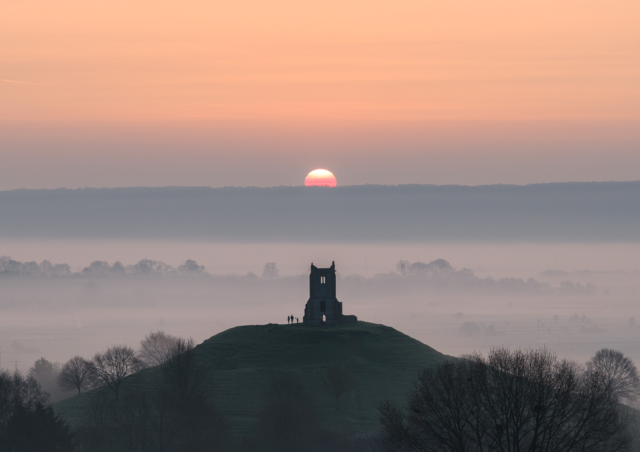
But some of my most-engaged posts have also been very simple, very quiet ground-level images – a misty morning on the Levels, a long exposure at the Gorge, something that doesn’t announce itself immediately but rewards a second look. The images that seem to connect most are the ones with some emotional quality to them, regardless of whether they were taken from the air or the ground. Which, if you’re looking for evidence that drone photography isn’t inherently superior or more engaging, is probably it.
What I’ve noticed is that aerial shots tend to get a quicker reaction – people respond to the novelty of the perspective immediately. Ground-based shots sometimes build more slowly but attract a different kind of engagement – more considered comments, more saves, more of the responses that suggest someone is genuinely connecting with the image rather than just being momentarily impressed by it. Neither is better. They’re just different.
Where I actually land on it
My honest position is this: drone photography is a legitimate and often extraordinary tool, and “cheating” is the wrong frame entirely. I rarely go out without my drone in my camera bag – just in case.
But – and this is the thing I keep coming back to – my ground-based images feel more like mine. There’s something about being physically present in a landscape, feeling the cold, smelling the morning, waiting for the light to do the thing you hoped it would do – that feeds into the image in a way I find hard to fully articulate. When I look at my favourite shots, the ones I’m most proud of, almost all of them were taken with my feet on the ground.
That’s not a statement about drone photography in general. It’s a statement about what photography means to me specifically. The drone is a brilliant tool. But for me, the connection between photographer and place is part of the point – and that connection is strongest when I’m actually standing in it.
So no, drone photography isn’t cheating. But it is a different thing. And I think being honest about that difference – rather than pretending the two are identical – is worth doing.
A practical note if you’re thinking about getting one
If you’re considering a drone for landscape photography, a few things worth knowing:
The DJI Mini range is the obvious starting point – under 250g, which puts it in a lighter regulatory category and makes it much more practical for travel. Image quality has improved dramatically over the last few generations. My Air 2S produced images I’m still printing and selling today; the Mavic 4 Pro is a significant step up again. It’s a lot bigger and heavier though, and hogs a huge amount of space in my camera bag.
Get your CAA flyer ID before you fly anything. It’s a short online course and test, and it’s a legal requirement. Download the NATS drone app and check it before every single flight – airspace restrictions change and vary by time of day.
The learning curve is real. But so is the ceiling once you’re past it.
Recommended prints
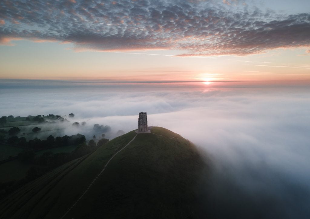
If you want to see what’s possible with a drone over Bristol and Somerset, have a browse of the gallery – there are a fair few aerial shots in there alongside the ground-based work. And if drone photography has you thinking about prints, the print shop has options from both perspectives, quite literally.
